
Page 13 - Mid America Boating - June 2024 issue
P. 13
I have seen ice completely change the struc-
ture of rocky reefs. As the ice breaks up, it
takes rocks frozen to it and deposits them in
totally new areas.
As you venture out on once familiar water-
ways, along routes you’ve set in your GPS – do
not depend on your electronics. You will need
to exercise extra caution and post a lookout
unless you want your boating season cut
short abruptly. You could also benefit by chat-
ting with local boaters in the area you plan
to navigate or contacting someone who has 13 [ MID-AMERICA BOATING ] JUNE 2024
recently passed along your intended course.
Call ahead to a port you plan to trailer your
vessel to and inquire regarding water depth at
the ramps. MAB
Perils of the Freshwater Seas, an anthology of
stories and experiences written by Captain Fred
Davis is available for $22.30 (includes shipping)
E-Mail: padavis2006@comcast.net
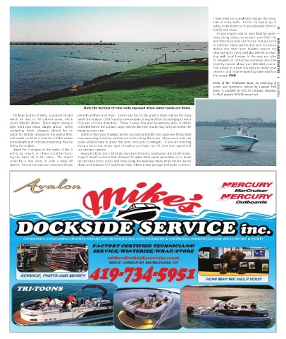
Note the number of new reefs exposed when water levels are down.
On large bodies of water, a lookout should set with anchors and chain. Debris can foul in the anchor chain pulling the buoy
watch for dark or off colored areas, which under the surface. If the V points downstream, it may indicate the merging of water
could indicate debris. White water during a from two or more directions. These V areas may also be warning signs of debris
light wind may mean danger ahead. When collected below the surface, large objects like tree trunks may lurk just below the
navigating rivers, skippers should be on merging water area.
watch for telltale changes in the waters flow; Some of the many changes winter and spring runoffs can cause are filling what
odd swirls could be a diversion of the waters once were deep holes by washed out banks along the shore. These wash outs can
normal path and indicate something may be cause shallow bars in areas that were once safe to navigate. If you are traveling
below the surface. along a bank that shows signs of washout or heavy run off, slow your speed and
Watch for V shapes in the water, if the V use extreme caution
points up stream, an object could be divert- Heavy ice from the cold winter may have frozen to riverbanks or rocky bottoms.
ing the water off to the sides. The object A quick runoff or storm that changes the water level could cause this ice to break
could be a tree trunk or even a buoy off up and carry rocks, docks and trees along the waterway many miles before the ice
station. Strong currents can overcome buoys thaws and releases its load along areas where a safe passage had been common.